Vincent's
Vincent's is a charity shop on Main Street in Oranmore, County Galway, on the centre. Supermac's, Texaco and Brazco are within 27 m.
- Kind
- Charity shops
- Street
- Main Street
- From the centre
- On the centre
- Bus stop
- Stop, 165 m away
The map does not yet record a phone number, a website or opening hours for Vincent's. Anyone can add them on OpenStreetMap; this page picks the change up at the next refresh.
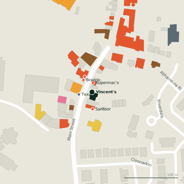
Plan of the surrounding 300 m
Getting to Vincent's
- By bus
- The nearest stop is an unnamed stop, 165 m away.
- Directions from where you are
- Open the model above, tap the pin and choose “Directions here”; the route is drawn from your own position.
While you are there
21 places to eat and drink within 300 m: Supermac's (17 m), Brazco (27 m), Apache Pizza (31 m) and Santoor (32 m) and more.
7 shops within 300 m, including Centra, Orlik and Wolf & West.
Main Street itself has 26 named places on the map.
How a charity shop works
A charity shop is a shop run by a charity to raise money: it sells goods the public has given, mostly clothes, books, records, shoes, toys and furniture, and it is usually staffed by volunteers. Because the stock costs nothing and the running costs are low, prices are low too, and whatever is left after rent, light and heat goes to the charity's work. The idea took hold in Britain during the Second World War, though a society for the blind in Wolverhampton had opened one as early as 1899.
Written from Wikipedia, "Charity shop" (CC BY-SA 4.0); the words are ours.
Within a short walk
- Supermac's17 mTakeaways
- Texaco25 mPetrol stations
- Brazco27 mCafés
- Apache Pizza31 mTakeaways
- Santoor32 mRestaurants
- Paddy Power36 mBookmaker
- Centra39 mConvenience stores
- Giovannis Oranmore44 mTakeaways
Also on Main Street
- Apache PizzaTakeaways
- Bank of IrelandBanks
- Bar One RacingBookmaker
- BrazcoCafés
- CentraConvenience stores
- Coach House HotelHotels
- Giovannis OranmoreTakeaways
Everything on Main Street (26 places)
Questions people ask
Where is Vincent's?
Source record: OpenStreetMap way/684671669, read on 2026-09-18. The street is the mapped address where there is one, otherwise the nearest named road. Distances are straight lines.