The N17 and the M17 at Tuam
The road the Saw Doctors sang about in 1991 starts, officially, at a roundabout on the edge of Tuam. The N17 runs 95 kilometres north from Kilmore through Milltown, Ballindine, Claremorris, Knock and Tubbercurry to Collooney, with no dual carriageway anywhere on it. South of Tuam the road it used to be is now the M17 motorway, opened on 27 September 2017, and the old road through Claregalway is the N83.
Checked against the source on 2026-09-19.
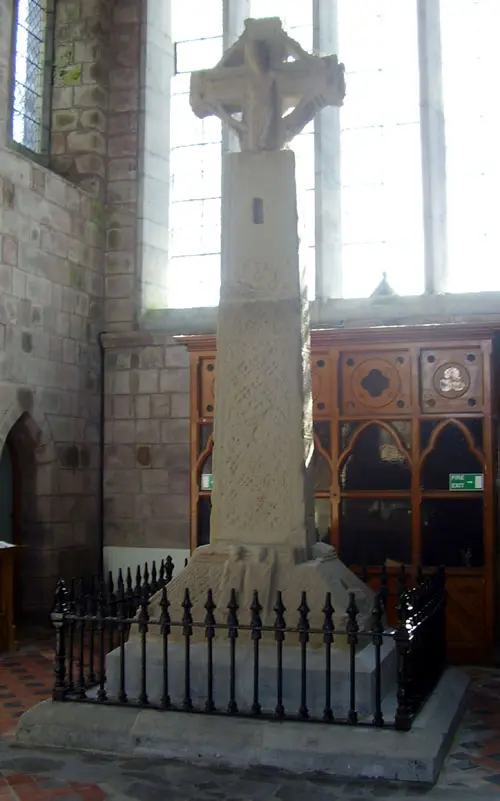
ClintMalpaso, CC BY-SA 3.0 via Wikimedia Commons

Tuam High Cross on the 3D model; tap a pin for its page and directions.
From Tuam north
Since 2017 the N17 bypasses Tuam and swings north-west towards Milltown, where a realigned stretch built in the late 1990s removed a notorious bend at a graveyard that had killed many, and a bad bend at Lisavalley went in 2012. Over the Mayo line at Ballindine the main street is wide enough to swallow the traffic; the 5 km to Claremorris was realigned in 1983 and carries almost 10,000 vehicles a day, and the 16 km Claremorris and Knock bypass from Lissduff is the biggest project on the road so far. In Sligo the road bypasses Curry on a 1993 stretch, then falls to a winding, low-quality road with a high fatality rate as far as Tubbercurry.
The M17
Before the motorway the southern N17 was the busiest single-carriageway inter-urban road in the country, with more than 25,000 vehicles a day at Claregalway and 20,000 south of it. The M17 took 25.5 km of it to motorway standard between Tuam and the M6 east of Galway, joining the M18 from Gort at the same junction, and the Kilmore Roundabout to the N6 became the N83; the N83 now runs 87.5 km from Ireland West Airport at Knock down to Tuam and on into the city. The road is part of the Atlantic Corridor with the N18 and N20. The model on this page pins Tuam's centre; the getting-here page has the buses that use the motorway.
Questions people ask
Is the road from Tuam to Galway a motorway?
Where does the N17 start and end?
Who sang N17?
Written from Wikipedia, "N17 road (Ireland)" (CC BY-SA 4.0), read on 2026-09-19, and from the OpenStreetMap places on the model. Nothing has been added from memory; follow the source for its footnotes.