Companies · Mervue Industrial Estate · Galway
IDA West
IDA West is a company on Mervue Industrial Estate in Galway, County Galway, 1.8 km north-east of Eyre Square. Avaya, O'Briens and Platform 94 are within 153 m.
- Kind
- Companies
- Street
- Mervue Industrial Estate
- From Eyre Square
- 1.8 km north-east
- Bus stop
- Well Park Estate (Bus Éireann), 186 m away
The map does not yet record a phone number, a website or opening hours for IDA West. Anyone can add them on OpenStreetMap; this page picks the change up at the next refresh.
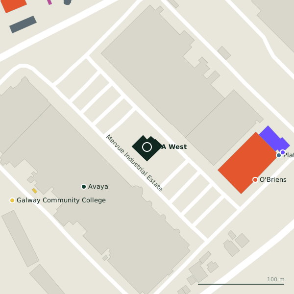
The building in black is this one; drag to turn the model.Open the whole town
Plan of the surrounding 300 m
Getting to IDA West
- By bus
- The nearest stop is Well Park Estate, served by Bus Éireann, 186 m away.
- Directions from where you are
- Open the model above, tap the pin and choose “Directions here”; the route is drawn from your own position.
While you are there
2 places to eat and drink within 300 m: O'Briens (131 m) and Burger King (233 m).
4 shops within 300 m, including Chadwicks, Wash Me and Carpets and Rug Centre.
Mervue Industrial Estate itself has 7 named places on the map.
Within a short walk
- Avaya86 mCompanies
- O'Briens131 mCafés
- Platform 94153 mCo-working
- Bank of Ireland157 mCash machines
- Galway Community College168 mSchools
- Airwire183 mCompanies
- Chadwicks184 mHardware
- Hogan Motros188 mCar dealers
Also on Mervue Industrial Estate
- AirwireCompanies
- Bank of IrelandCash machines
- Galway Community CollegeSchools
- GRETB Training CentreColleges
- O'BriensCafés
- Platform 94Co-working
Other companies in Galway
- 86 m
- Airwire183 mMervue Industrial Estate
- The Rhatigan Group392 mMonivea Road
- Arm Technologies402 mMonivea Road
- Carey Building Contractors420 mTuam Road
- Trinzo427 mMonivea Road
- Arup Consulting430 mMonivea Road
- 523 m
Questions people ask
Where is IDA West?
On Mervue Industrial Estate in Galway, 1.8 km north-east of Eyre Square.
Are there other companies nearby?
111 other companies in $Galway; the closest is Avaya, 86 m away.
Source record: OpenStreetMap node/11153371488, read on 2026-09-18. The street is the mapped address where there is one, otherwise the nearest named road. Distances are straight lines.