Burns Construction & Civil Engineering
Burns Construction & Civil Engineering is a company on Tuam Road in Galway, County Galway, 1.6 km north-east of Eyre Square. OnePageCRM, DM Female Only Gym Galway and The MoneyButler Limited are within 33 m.
The map does not yet record a phone number, a website or opening hours for Burns Construction & Civil Engineering. Anyone can add them on OpenStreetMap; this page picks the change up at the next refresh.
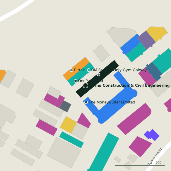
Plan of the surrounding 300 m
Getting to Burns Construction & Civil Engineering
- By bus
- The nearest stop is Tuam Road, served by Bus Éireann, 314 m away, with a shelter.
- Directions from where you are
- Open the model above, tap the pin and choose “Directions here”; the route is drawn from your own position.
While you are there
6 places to eat and drink within 300 m: COCO Café (92 m), O'Briens (105 m), Bare Pantry cafe (107 m) and Mocha Beans (124 m) and more.
19 shops within 300 m, including African Pride Store, Celtic Futon Store and Flowers.ie.
Tuam Road itself has 101 named places on the map.
Within a short walk
- OnePageCRM22 mIT companies
- 31 m
- The MoneyButler Limited33 mFinancial advisor
- Rad Fix Galway34 mGarages
- Pirtek41 mGarages
- Atlantic Print & Design43 mCopyshop
- Feature Fireplaces43 mFireplace
- Lock Doctor Galway45 mLocksmith
Also on Tuam Road
- Ability WestCharity shops
- Ace PrintersPrinter ink
- African Pride StoreConvenience stores
- AIBCash machines
- All 4 BabyBaby goods
- ApplegreenPetrol stations
- Atlantic Print & DesignCopyshop
- Bank of IrelandCash machines
Everything on Tuam Road (101 places)
Other companies in Galway
- Carey Building Contractors161 mTuam Road
- Airwire341 mMervue Industrial Estate
- 463 m
- IDA West523 mMervue Industrial Estate
- The Rhatigan Group883 mMonivea Road
- Arm Technologies886 mMonivea Road
- Trinzo910 mMonivea Road
- Arup Consulting920 mMonivea Road
Questions people ask
Where is Burns Construction & Civil Engineering?
Are there other companies nearby?
Source record: OpenStreetMap node/8839145628, read on 2026-09-18. The street is the mapped address where there is one, otherwise the nearest named road. Distances are straight lines.