Convenience stores · Dublin Road · Galway
Londis
Londis is a convenience store on Dublin Road in Galway, County Galway, 1.6 km north-east of Eyre Square. Bank of Ireland, Bathroom World and Kia are within 56 m.
- Street
- Dublin Road
- From Eyre Square
- 1.6 km north-east
- Wheelchair
- Accessible
- Bus stop
- Dublin Rd (Woodlands) (Bus Éireann), 38 m away
The map does not yet record a phone number, a website or opening hours for Londis. Anyone can add them on OpenStreetMap; this page picks the change up at the next refresh.
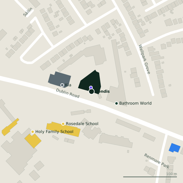
The building in black is this one; drag to turn the model.Open the whole town
Plan of the surrounding 300 m
Getting to Londis
- By bus
- The nearest stop is Dublin Rd (Woodlands), served by Bus Éireann, 38 m away, with a shelter.
- Directions from where you are
- Open the model above, tap the pin and choose “Directions here”; the route is drawn from your own position.
While you are there
1 shop within 300 m, including Lidl.
Dublin Road itself has 24 named places on the map.
Within a short walk
- Bank of Ireland7 mCash machines
- Bathroom World51 mBathroom furnishing
- Kia56 mCar dealers
- Rosedale School80 mSchools
- Holy Family School132 mSchools
- Brothers of Charity Woodlands141 mNursing homes
- Lakeview School181 mSchools
- Renmore Dental185 mDentists
Also on Dublin Road
- 7th Day Adventist ChurchChurches
- Atlantic Technological University GalwayUniversities
- Bank of IrelandCash machines
- Bathroom WorldBathroom furnishing
- Brothers of Charity WoodlandsNursing homes
- Carry OutOff licences
- EuronetCash machines
Everything on Dublin Road (24 places)
Other convenience stores in Galway
- Spar370 mRenmore Road
- Polonez775 mTuam Road
- Londis844 mPlunket Avenue
- Moldova856 mTuam Road
- African Pride Store971 mTuam Road
- Limeleaf XL1.1 kmFuschia Drive
- Spar1.1 kmTuam Road
- Paper Chase1.3 kmHeadford Road
Questions people ask
Where is Londis?
On Dublin Road in Galway, 1.6 km north-east of Eyre Square.
Are there other convenience stores nearby?
81 other convenience stores in $Galway; the closest is Spar, 370 m away.
Source record: OpenStreetMap node/1728439947, read on 2026-09-18. The street is the mapped address where there is one, otherwise the nearest named road. Distances are straight lines.