Convenience stores · Renmore Road · Galway
Spar
Spar is a convenience store on Renmore Road in Galway, County Galway, 1.9 km east of Eyre Square. Renmore Post Office, Duggan's Pharmacy and Ulster Bank are within 9 m.
- Street
- Renmore Road
- From Eyre Square
- 1.9 km east
- Run by
- Duggans
- Wheelchair
- Accessible
- Bus stop
- Bon Secours Hospl (Bus Éireann), 14 m away
The map does not yet record a phone number, a website or opening hours for Spar. Anyone can add them on OpenStreetMap; this page picks the change up at the next refresh.
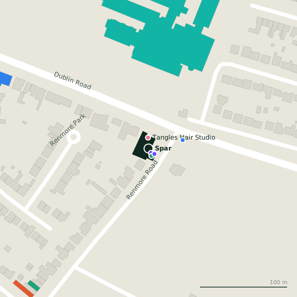
The building in black is this one; drag to turn the model.Open the whole town
Plan of the surrounding 300 m
Getting to Spar
- By bus
- The nearest stop is Bon Secours Hospl, served by Bus Éireann, 14 m away.
- Directions from where you are
- Open the model above, tap the pin and choose “Directions here”; the route is drawn from your own position.
While you are there
1 place to eat or drink within 300 m: The Full Duck (215 m).
Renmore Road itself has 8 named places on the map.
Within a short walk
- Renmore Post Office6 mPost office
- Duggan's Pharmacy9 mPharmacies
- Ulster Bank9 mCash machines
- Tangles Hair Studio13 mHairdressers
- Bon Secours Hospital Galway40 mHospital
- Connacht Hotel Galway89 mHotels
- 110 m
- Renmore Dental186 mDentists
Also on Renmore Road
- Bon Secours Hospital GalwayHospital
- Duggan's PharmacyPharmacies
- Renmore PharmacyPharmacies
- Renmore Post OfficePost office
- Saint Patrick's Garrison ChurchChurches
- The Full DuckCafés
- Ulster BankCash machines
Other convenience stores in Galway
- Londis370 mDublin Road
- Limeleaf XL772 mFuschia Drive
- Londis821 mPlunket Avenue
- 4 Seasons976 mLurgan Park
- Polonez1.1 kmTuam Road
- Moldova1.2 kmTuam Road
- Merlin Stores1.2 kmDublin Road
- Spar1.2 kmTuam Road
Questions people ask
Where is Spar?
On Renmore Road in Galway, 1.9 km east of Eyre Square.
Are there other convenience stores nearby?
81 other convenience stores in $Galway; the closest is Londis, 370 m away.
Source record: OpenStreetMap node/2274624297, read on 2026-09-18. The street is the mapped address where there is one, otherwise the nearest named road. Distances are straight lines.