RSA Insurance
RSA Insurance is an insurance on Western Distributor Road in Galway, County Galway, 3.2 km west of Eyre Square. ReproMed Galway, Gaelscoil Mhic Amhlaidh and Boots are within 140 m.
- Kind
- Insurance
- Street
- Western Distributor Road
- From Eyre Square
- 3.2 km west
- Wheelchair
- Accessible
- Bus stop
- Aviva (CityDirect), 61 m away
The map does not yet record a phone number, a website or opening hours for RSA Insurance. Anyone can add them on OpenStreetMap; this page picks the change up at the next refresh.
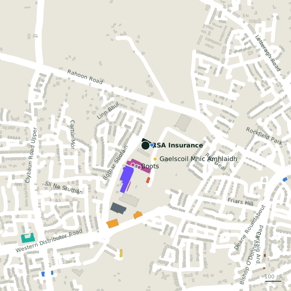
Plan of the surrounding 300 m
Getting to RSA Insurance
- By bus
- The nearest stop is Aviva, served by CityDirect, 61 m away.
- Directions from where you are
- Open the model above, tap the pin and choose “Directions here”; the route is drawn from your own position.
While you are there
4 places to eat and drink within 300 m: Synge & Byrne (150 m), KFC (203 m), PizzaList (218 m) and Costa (221 m).
6 shops within 300 m, including Regatta Great Outdoors, Harvey Norman and Carraig Donn.
Western Distributor Road itself has 29 named places on the map.
Within a short walk
- ReproMed Galway40 mClinics
- Gaelscoil Mhic Amhlaidh104 mSchools
- Boots140 mPharmacies
- Regatta Great Outdoors140 mOutdoor shops
- Harvey Norman142 mDepartment stores
- Carraig Donn143 mClothes shops
- Specsavers147 mOpticians
- Synge & Byrne150 mCafés
Also on Western Distributor Road
- AldiSupermarkets
- B&QHardware
- B&Q Garden CentreGarden centres
- BootsPharmacies
- Carraig DonnClothes shops
- Dunnes StoresSupermarkets
- EcoFuel Ware+Store® GalwayPetrol stations
Everything on Western Distributor Road (29 places)
Other insurance in Galway
- Acorn Insurance3.0 kmCross Street Lower
- AXA3.1 kmBóthar Irwin
- Champion Insurance3.2 kmMerchants Road
- Mapfre Assistance3.3 kmProspect Hill
- FBD Insurance3.9 kmSean Mulvoy Road
- Murray and Spelman4.2 kmGalway Financial Services Centre
- Hooper Dolan Insurances4.4 kmTuam Road
- O'Leary Insurance Group4.5 kmTuam Road
Questions people ask
Where is RSA Insurance?
Are there other insurance nearby?
Source record: OpenStreetMap node/10197731677, read on 2026-09-18. The street is the mapped address where there is one, otherwise the nearest named road. Distances are straight lines.