Saint Patrick's Church
Saint Patrick's Church is a church on Bóthar Bhreandán Ui Eithir in Galway, County Galway, 227 m north-east of Eyre Square. It Music, Forster Court Dental and Prometric Test Center are within 45 m.
- Kind
- Churches
- From Eyre Square
- 227 m north-east
- Parking
- Corrib Centre Car Park, 270 m away
- Bus stop
- Forster Court (Bus Éireann), 50 m away
The map does not yet record a phone number, a website or opening hours for Saint Patrick's Church. Anyone can add them on OpenStreetMap; this page picks the change up at the next refresh.
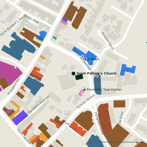
Plan of the surrounding 300 m
Getting to Saint Patrick's Church
- By car
- Park at Corrib Centre Car Park, 270 m away, paid.
- By bus
- The nearest stop is Forster Court, served by Bus Éireann, 50 m away.
- Directions from where you are
- Open the model above, tap the pin and choose “Directions here”; the route is drawn from your own position.
While you are there
44 places to eat and drink within 300 m: Jungle Café (88 m), Osaka (94 m), The Ol’ 55 (99 m) and WYLDE (99 m) and more.
20 shops within 300 m, including Armazém Brazil, TK Maxx and Gala.
Bóthar Bhreandán Ui Eithir itself has 3 named places on the map.
Within a short walk
- It Music43 mMusical instrument
- Forster Court Dental45 mDentists
- Prometric Test Center45 mCompanies
- Turkish Barber50 mHairdressers
- Sherry FitzGerald55 mEstate agents
- Aran Island Ferries56 mVisitor information
- Magdalene Laundry57 mMonuments
- SIPTU59 mUnion
Also on Bóthar Bhreandán Ui Eithir
- Sherry FitzGeraldEstate agents
- SIPTUUnion
Other churches in Galway
- United Methodist Presbyterian Church335 mQueen Street
- Saint Francis "The Abbey"499 mSaint Francis Street
- Saint Augustine Church557 mMiddle Street
- Church of Saint Nicholas593 mLombard Street
- Galway Cathedral727 mGaol Road
- Bohermore Cemetery Chapel768 mBohermore
- Cemetery Chapel852 mBohermore
- Zen dojo892 mDominick Street Lower
Questions people ask
Where is Saint Patrick's Church?
Are there other churches nearby?
Source record: OpenStreetMap way/47088145, read on 2026-09-18. The street is the mapped address where there is one, otherwise the nearest named road. Distances are straight lines.