Bohermore Cemetery Chapel
Bohermore Cemetery Chapel is a church on Bohermore in Galway, County Galway, 994 m north-east of Eyre Square. Cemetery Chapel, Circle K and Swuite Galway are within 122 m.
The map does not yet record a phone number, a website or opening hours for Bohermore Cemetery Chapel. Anyone can add them on OpenStreetMap; this page picks the change up at the next refresh.
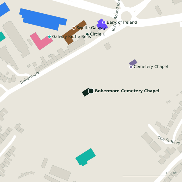
Plan of the surrounding 300 m
Getting to Bohermore Cemetery Chapel
- By car
- Park at Dyke Road Car Park on Dyke Road, 886 m away, paid.
- By bus
- The nearest stop is Bohermore, served by Bus Éireann, 97 m away.
- Directions from where you are
- Open the model above, tap the pin and choose “Directions here”; the route is drawn from your own position.
While you are there
1 place to eat or drink within 300 m: The Clan Bar (184 m).
5 shops within 300 m, including Sliding Wardrobes, Better Bedding and Galway Simon Community Furniture & Fashion Shop.
Bohermore itself has 9 named places on the map.
Within a short walk
- Cemetery Chapel88 mChurches
- Circle K106 mCar wash
- Swuite Galway122 mHotels
- Galway Kettle Bells128 mSports centres
- Bank of Ireland130 mCash machines
- 134 m
- 135 m
- FBD Insurance144 mInsurance
Also on Bohermore
- Art TattooTattoo studios
- Cemetery ChapelChurches
- Circle KCar wash
- City Property ServicesEstate agents
- Fade FactoryHairdressers
- Harry’sPubs
- Peig’s BarPubs
Other churches in Galway
- Cemetery Chapel88 mBohermore
- Connect Church742 mTuam Road
- Saint Patrick's Church768 mBóthar Bhreandán Ui Eithir
- Galway Mosque East886 mSandy View Drive
- United Methodist Presbyterian Church1.1 kmQueen Street
- Saint Patrick's Garrison Church1.1 kmRenmore Road
- 1.2 km
- Saint Francis "The Abbey"1.2 kmSaint Francis Street
Questions people ask
Where is Bohermore Cemetery Chapel?
Are there other churches nearby?
Source record: OpenStreetMap way/176487944, read on 2026-09-18. The street is the mapped address where there is one, otherwise the nearest named road. Distances are straight lines.