Companies · Galway
The Loft
The Loft is a company in the town in Galway, County Galway, 4.4 km north-east of Eyre Square. Prevos Solutions, Salt Float & Recovery and Munster Joinery are within 11 m.
- Kind
- Companies
- From Eyre Square
- 4.4 km north-east
- Bus stop
- An Luasán (Bus Éireann), 297 m away
The map does not yet record a phone number, a website or opening hours for The Loft. Anyone can add them on OpenStreetMap; this page picks the change up at the next refresh.
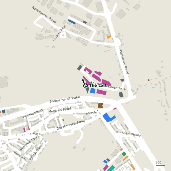
The building in black is this one; drag to turn the model.Open the whole town
Plan of the surrounding 300 m
Getting to The Loft
- By bus
- The nearest stop is An Luasán, served by Bus Éireann, 297 m away.
- Directions from where you are
- Open the model above, tap the pin and choose “Directions here”; the route is drawn from your own position.
While you are there
3 places to eat and drink within 300 m: Grindhouse Cafe (39 m), Roots (223 m) and Enclosure Bar & Bistro (272 m).
12 shops within 300 m, including NorDan, The Equine Warehouse and Galway SPCA.
Within a short walk
- Prevos Solutions3 mIT companies
- Salt Float & Recovery7 mClinics
- Munster Joinery11 mConstruction company
- Optimum Body18 mPhysiotherapist
- Stephanie Dowling Folan20 mTherapist
- Claudia Doherty22 mConsulting
- Bidvest Noonan27 mCompanies
- Adare Beverages28 mBeverages
Other companies in Galway
- 27 m
- Acal Technologies55 mBriarhill Business Park
- Wesfile Limiited56 mBriarhill Business Park
- Megadale Automation123 mBriarhill Business Park
- EZ Living furniture Head Office126 mBriarhill Business Park
- Kelly Services130 mBriarhill Business Park
- CGA Technology135 mBriarhill Business Park
- 137 m
Questions people ask
Where is The Loft?
In Galway, County Galway, 4.4 km north-east of Eyre Square.
Are there other companies nearby?
111 other companies in $Galway; the closest is Bidvest Noonan, 27 m away.
Source record: OpenStreetMap node/11151237257, read on 2026-09-18. The street is the mapped address where there is one, otherwise the nearest named road. Distances are straight lines.