Churches · Doughiska Road · Galway
Good Shepherd Parish
Good Shepherd Parish is a church on Doughiska Road in Galway, County Galway, 4.9 km east of Eyre Square. Spar, Stylistic Hair & Beauty and Nevins Pharmacy are within 91 m.
- Kind
- Churches
- Street
- Doughiska Road
- From Eyre Square
- 4.9 km east
- Website
- goodshepherdparish.ie
- Wheelchair
- Accessible
- Bus stop
- Stop (Bus Éireann), 95 m away
The map does not yet record a phone number or opening hours for Good Shepherd Parish. Anyone can add them on OpenStreetMap; this page picks the change up at the next refresh.
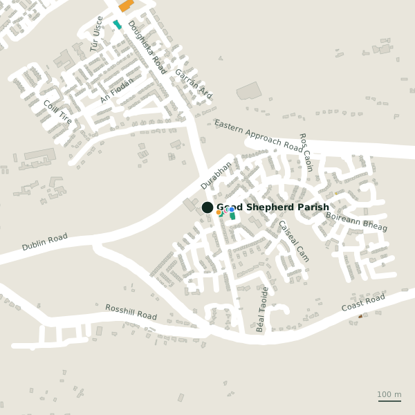
The building in black is this one; drag to turn the model.Open the whole town
Plan of the surrounding 300 m
Getting to Good Shepherd Parish
- By bus
- The nearest stop is an unnamed stop, served by Bus Éireann, 95 m away, with a shelter.
- Directions from where you are
- Open the model above, tap the pin and choose “Directions here”; the route is drawn from your own position.
While you are there
1 shop within 300 m, including Spar.
Doughiska Road itself has 8 named places on the map.
Within a short walk
- Spar53 mConvenience stores
- Stylistic Hair & Beauty82 mHairdressers
- Nevins Pharmacy91 mPharmacies
- Roscam Family Dental Practice98 mDentists
- Roscam Medical Practice107 mDoctors
- Cheshire House187 mSocial services
Also on Doughiska Road
- Coynes FoodmarketConvenience stores
- Hustle GymGyms
- LidlSupermarkets
- Merlin PharmacyPharmacies
- Tesco ExpressConvenience stores
- The GroveConvenience stores
Other churches in Galway
- 1.2 km
- 7th Day Adventist Church1.6 kmDublin Road
- 1.9 km
- Mary Mosque2.0 kmOld Monivea Road
- Word Alive Bible Ministry2.4 kmOldenway Business Park
- Mountain of Fire & Miracles Ministry2.4 kmOldenway Business Park
- Redeemed Christian Church of God2.4 kmOldenway Business Park
- 2.6 km
Questions people ask
Where is Good Shepherd Parish?
On Doughiska Road in Galway, 4.9 km east of Eyre Square.
Are there other churches nearby?
40 other churches in $Galway; the closest is Hospital Chapel, 1.2 km away.
Source record: OpenStreetMap node/1986312555, read on 2026-09-18. The street is the mapped address where there is one, otherwise the nearest named road. Distances are straight lines.