Knocknacarra
In the 1980s and 1990s Knocknacarra was still mostly fields. By 2021 it held something like 17,000 to 18,000 people, up from a little over 12,000 in 2004, and it was being described as the fastest-growing suburb in Galway. It lies on the bay about five kilometres west of the centre, with Salthill to the south-east, Barna to the west and Cappagh Park running straight into Barna Woods.
Checked against the source on 2026-09-19.
Seod13ie, CC0 via Wikimedia Commons

Knocknacarra Community Centre, Knocknacarra Medical Centre, Knocknacarra National School, Knocknacarra Educate Together National School on the 3D model; tap a pin for its page and directions.
From 97 people to a suburb
Ringforts, a horizontal watermill, a holy well, an enclosure and middens show ancient settlement in the townland, which lies in the parish of Rahoon. There were 97 people here in the 1810s and 153 in 1913, still counted as rural. Building began in the 1970s, with a sewage system nearing completion by 1973, and in 1986, under the Local Government (Reorganisation) Act, the area passed from the county council to Galway Corporation.
Shops, schools and Irish
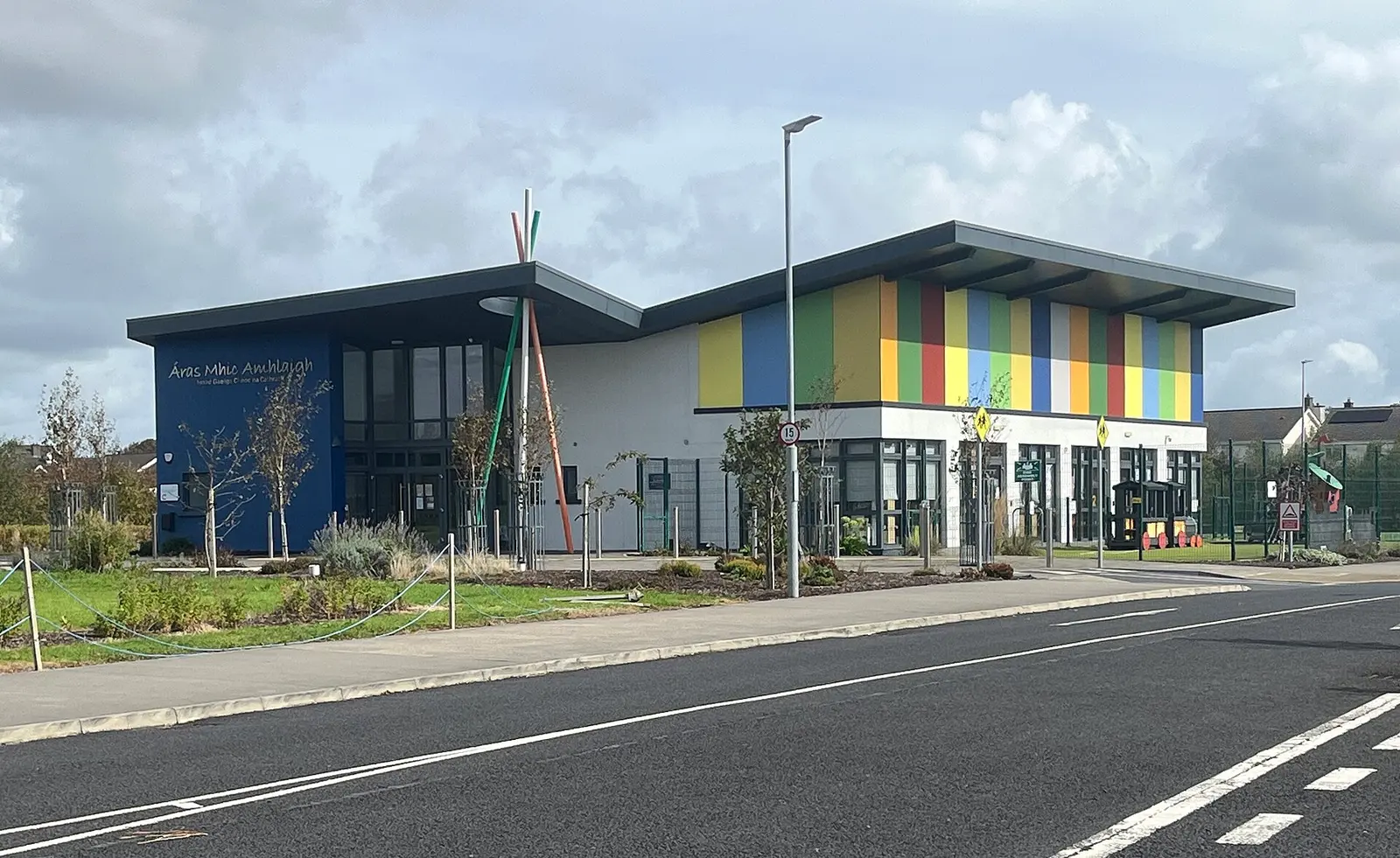
Most of the suburb is housing, with shops and cafés around the Gateway Retail Park, where Dunnes, B&Q and Harvey Norman are tenants, and a Lidl, Aldi and Tesco nearby; locals call the Dunnes the fancy Dunnes for its homeware, clothing, deli and cheese counter. Knocknacarra Community Centre is one of three run by the city council, and the Catholic church is dedicated to St John the Apostle. Parts of the west and south are inside the Gaeltacht, and with Barna the area is a Language Planning Area; Áras Mhic Amhlaigh opened in September 2022 as an Irish-language centre and naíonra, and Coláiste na Coiribe, the only secondary school, was described in 2017 as the largest Irish-medium secondary school in the country.
Getting in and out
The Western Distributor Road, 2.9 km from the Cappagh Roundabout to the Deane Roundabout, is the spine, with four minor north-south roads off it and the R336 through the area. CityDirect routes 410, via Salthill, 411, via Westside, and 412, the direct one, run to Eyre Square. Congestion and public transport have drawn criticism. Salthill-Knocknacarra GAA and Galway Bay Rugby Club, founded in 2007 as Barna Knocknacarra, are the clubs. The model pins the community centre, medical centre and schools.
Questions people ask
How many people live in Knocknacarra?
Which buses go from Knocknacarra to Galway city centre?
Is Knocknacarra in the Gaeltacht?
Written from Wikipedia, "Knocknacarra" (CC BY-SA 4.0), read on 2026-09-19, and from the OpenStreetMap places on the model. Nothing has been added from memory; follow the source for its footnotes.