The River Corrib
The river that splits Galway in two is one of the shortest in Europe: six kilometres from the southern end of Lough Corrib to the salt water of the bay. It is also, by the volume it carries, the second river in Ireland after the Shannon, with a long-term average flow of about 105 cubic metres a second and a catchment of 3,138 square kilometres behind it, which is why it roars under the Salmon Weir Bridge after rain and why the kayakers love it.
Checked against the source on 2026-09-19.
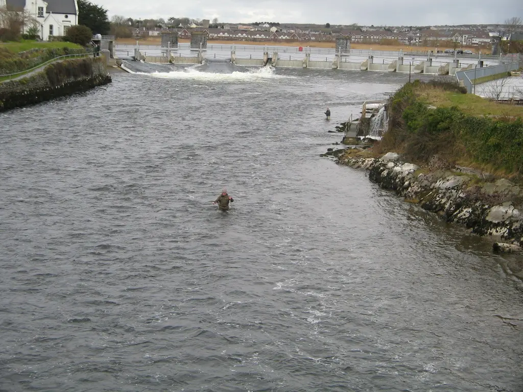
No machine-readable author provided. Gronico~commonswiki assumed (based on copyr, CC BY 2.5 via Wikimedia Commons

Salmon Weir Bridge, Fisheries Field, Galway Cathedral on the 3D model; tap a pin for its page and directions.
The river that named the city
In Irish the river is Abhainn na Gaillimhe, the Galway river, sometimes simply An Ghaillimh. The legend is that it was named after Gaillimh, daughter of a Fir Bolg chieftain, who drowned in it; the word itself is thought to mean stony. The often-repeated idea that Galway means the town of the foreigners, from Gall, is wrong: the name belonged to the river first and passed to the settlement at its mouth, Dún Bhun na Gaillimhe, the fort at the end of the Galway. The town took the river's name, and from about 1570 the county took the town's.
The river also drove the town's industry. Its fall between lake and sea let Galway generate hydro-electricity for the public before London had it.
Upper and Lower Corrib
From the lake to the Salmon Weir the river is the Upper Corrib. The main channel out of the lake is the Friars' Cut, Abhainn na mBráithre, an early piece of canal work: in 1178 the friars of Claregalway, tired of the long detour west to reach the river, asked the Blakes of Menlo for leave to dig a cut, which in time became the main course and was widened. The weir was built of stone and timber as part of the navigation scheme; two of the old gates remain and open only in flood, and fourteen steel gates do the rest.
Below the weir, through the city and out to the bay, is the Lower Corrib, crossed by the Salmon Weir Bridge, the William O'Brien Bridge and the Wolfe Tone Bridge. Upstream stands the Quincentenary Bridge, and in 2023 a pedestrian bridge, Droichead an Dóchais, was completed, making five in the city; a sixth, above the Quincentenary Bridge, is proposed as part of the N6 ring road.
On the water
The Corrib is popular with whitewater kayakers and with several rowing clubs, whose boathouses line the bank below the university, and with pleasure craft heading up to the lake. Its depth reaches about 94 feet. The Salmon Weir Bridge is the place to stand in early summer to watch the salmon holding in the current below the weir; the model on this page pins the bridge and the riverside walks.
Questions people ask
How long is the River Corrib?
Is the Corrib a big river?
How many bridges cross the Corrib in Galway?
Why is Galway called Galway?
Written from Wikipedia, "River Corrib" (CC BY-SA 4.0), read on 2026-09-19, and from the OpenStreetMap places on the model. Nothing has been added from memory; follow the source for its footnotes.