Circle K
Circle K is a petrol station on College Road in Galway, County Galway, 1.2 km north-east of Eyre Square. Paddy Power, Bank of Ireland and The Huntsman Inn are within 54 m.
- Kind
- Petrol stations
- Street
- College Road
- From Eyre Square
- 1.2 km north-east
- Run by
- Circle K
- Bus stop
- Dublin Rd (Opp G Hotel) (Bus Éireann), 104 m away
The map does not yet record a phone number, a website or opening hours for Circle K. Anyone can add them on OpenStreetMap; this page picks the change up at the next refresh.
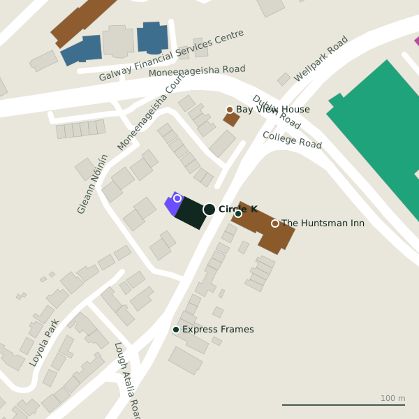
Plan of the surrounding 300 m
Getting to Circle K
- By bus
- The nearest stop is Dublin Rd (Opp G Hotel), served by Bus Éireann, 104 m away, with a shelter.
- Directions from where you are
- Open the model above, tap the pin and choose “Directions here”; the route is drawn from your own position.
While you are there
4 places to eat and drink within 300 m: The Huntsman Inn (54 m), Esquires Coffee (173 m), Shake Dog (194 m) and Friends Restaurant (247 m).
10 shops within 300 m, including DFS, Petmania and Cane & Rattan Furniture Studio.
College Road itself has 12 named places on the map.
Within a short walk
- Paddy Power23 mBookmaker
- Bank of Ireland27 mCash machines
- The Huntsman Inn54 mPubs
- Bay View House83 mGuest houses
- Express Frames101 mFrame
- Coyle Kennedy138 mEngineers
- Deacy Gilligan Accountants139 mAccountants
- Murray and Spelman141 mInsurance
Also on College Road
- Ardawn HouseGuest houses
- Bay View HouseGuest houses
- Dexcom StadiumStadium
- Galway City CouncilGovernment offices
- Galway City HallCouncil offices
- Paddy PowerBookmaker
- The Clan BarPubs
Everything on College Road (12 places)
Other petrol stations in Galway
- Applegreen644 mTuam Road
- Sweeney Oil870 mHeadford Road
- Texaco1.3 kmLough Atalia Road
- Circle K Express1.6 kmTuam Road
- Circle K2.0 kmLower Newcastle Road
- Circle K2.1 kmBóthar Na dTreabh
- Circle K2.5 kmSeamus Quirke Road
- Maxol2.6 kmFather Griffin Road
Questions people ask
Where is Circle K?
Are there other petrol stations nearby?
Source record: OpenStreetMap way/100009342, read on 2026-09-18. The street is the mapped address where there is one, otherwise the nearest named road. Distances are straight lines.