Pubs · College Road · Galway
The Clan Bar
The Clan Bar is a pub on College Road in Galway, County Galway, 861 m north-east of Eyre Square. Connacht Rugby Gym, Dexcom Stadium and Ardawn House are within 127 m.
- Kind
- Pubs
- Street
- College Road
- From Eyre Square
- 861 m north-east
- Parking
- Dyke Road Car Park on Dyke Road, 827 m away
- Bus stop
- Connacht Rugby (Bus Éireann), 93 m away
The map does not yet record a phone number, a website or opening hours for The Clan Bar. Anyone can add them on OpenStreetMap; this page picks the change up at the next refresh.
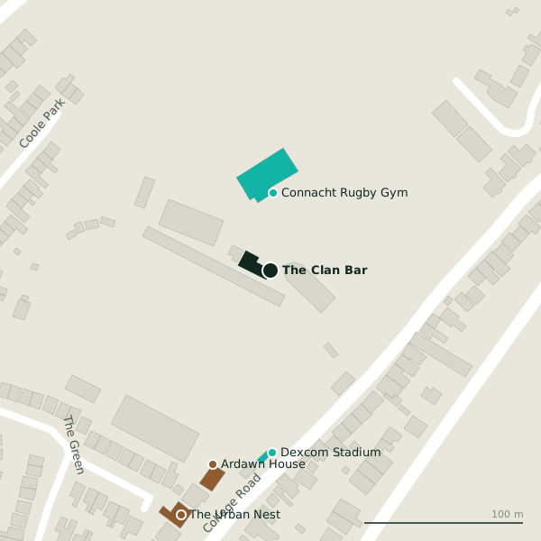
The building in black is this one; drag to turn the model.Open the whole town
Plan of the surrounding 300 m
Getting to The Clan Bar
- By car
- Park at Dyke Road Car Park on Dyke Road, 827 m away, paid.
- By bus
- The nearest stop is Connacht Rugby, served by Bus Éireann, 93 m away.
- Directions from where you are
- Open the model above, tap the pin and choose “Directions here”; the route is drawn from your own position.
While you are there
College Road itself has 12 named places on the map.
Within a short walk
- 49 m
- Dexcom Stadium115 mStadium
- Ardawn House127 mGuest houses
- The Urban Nest163 mHotels
- Bohermore Cemetery Chapel183 mChurches
- Cemetery Chapel243 mChurches
Also on College Road
- Ardawn HouseGuest houses
- Bay View HouseGuest houses
- Circle KPetrol stations
- Dexcom StadiumStadium
- Galway City CouncilGovernment offices
- Galway City HallCouncil offices
- Paddy PowerBookmaker
Everything on College Road (12 places)
Other pubs in Galway
- The Huntsman Inn421 mCollege Road
- Harry’s520 mBohermore
- Crowe’s Sports Bar539 mBohermore
- Peig’s Bar551 mBohermore
- The Ol’ 55716 mProspect Hill
- Murty Rabbit’s731 mForster Street
- An Púcán775 mForster Street
- Screene's on the Square780 mProspect Hill
Questions people ask
Where is The Clan Bar?
On College Road in Galway, 861 m north-east of Eyre Square; the nearest car park is 827 m away.
Are there other pubs nearby?
74 other pubs in $Galway; the closest is The Huntsman Inn, 421 m away.
Source record: OpenStreetMap way/303644909, read on 2026-09-18. The street is the mapped address where there is one, otherwise the nearest named road. Distances are straight lines.