Christ the King
Christ the King is a church on Upper Salthill Road in Galway, County Galway, 2.4 km south-west of Eyre Square. Bank of Ireland, Trend’s and Mocha Beans are within 77 m.
- Kind
- Churches
- Street
- Upper Salthill Road
- From Eyre Square
- 2.4 km south-west
- Wheelchair
- Accessible
- Parking
- National Aquarium Car Park on Seapoint Promenade, 220 m away
- Bus stop
- Salthill Church (Bus Éireann), 102 m away
The map does not yet record a phone number, a website or opening hours for Christ the King. Anyone can add them on OpenStreetMap; this page picks the change up at the next refresh.
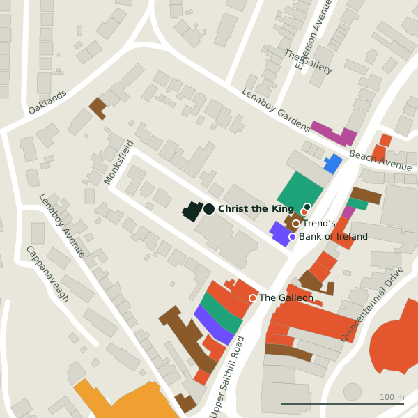
Plan of the surrounding 300 m
Getting to Christ the King
- By car
- Park at National Aquarium Car Park on Seapoint Promenade, 220 m away, free, 27 spaces.
- By bus
- The nearest stop is Salthill Church, served by Bus Éireann, 102 m away.
- Directions from where you are
- Open the model above, tap the pin and choose “Directions here”; the route is drawn from your own position.
While you are there
27 places to eat and drink within 300 m: Trend’s (72 m), Mocha Beans (77 m), The Galleon (81 m) and Supermac's (88 m) and more.
10 shops within 300 m, including Salthill Launderette, Shannon Dry Cleaners and Centra.
Upper Salthill Road itself has 70 named places on the map.
Within a short walk
- Bank of Ireland72 mCash machines
- Trend’s72 mPubs
- Mocha Beans77 mCafés
- BoyleSports80 mBookmaker
- The Galleon81 mRestaurants
- Top Fade Turkish barber83 mHairdressers
- Life Pharmacy86 mPharmacies
- Supermac's88 mTakeaways
Also on Upper Salthill Road
- AIBBanks
- Andrea ConcannonOpticians
- Baily Point PhysiotherapyPhysiotherapist
- Bank of IrelandCash machines
- Bank of IrelandCash machines
- Bayview Holiday ParkCaravan parks
- BeaconPubs
Everything on Upper Salthill Road (70 places)
Other churches in Galway
- 1.4 km
- Saint Mary's Priory1.6 kmCladdagh Quay
- Zen dojo1.7 kmDominick Street Lower
- Saint Joseph's1.7 kmPresentation Road
- 1.8 km
- 1.9 km
- Galway Christian Fellowship - West1.9 kmKingston Road
- Church of Saint Nicholas2.0 kmLombard Street
Questions people ask
Where is Christ the King?
Are there other churches nearby?
Source record: OpenStreetMap way/37208306, read on 2026-09-18. The street is the mapped address where there is one, otherwise the nearest named road. Distances are straight lines.