Galway Christian Fellowship - West
Galway Christian Fellowship - West is a church on Kingston Road in Galway, County Galway, 4.0 km west of Eyre Square. Kingston Dental, Knocknacarra District Community Scheme and Leo Walsh Pharmacy are within 17 m.
- Kind
- Churches
- Street
- Kingston Road
- From Eyre Square
- 4.0 km west
- Wheelchair
- Accessible
- Bus stop
- Shangort Road (Bus Éireann), 128 m away
The map does not yet record a phone number, a website or opening hours for Galway Christian Fellowship - West. Anyone can add them on OpenStreetMap; this page picks the change up at the next refresh.
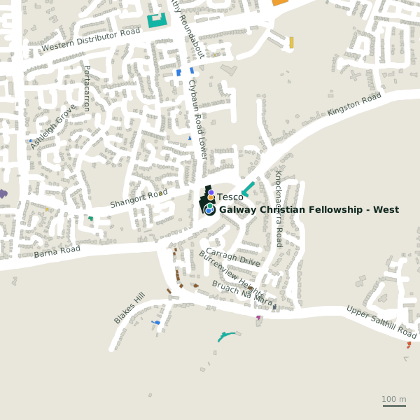
Plan of the surrounding 300 m
Getting to Galway Christian Fellowship - West
- By bus
- The nearest stop is Shangort Road, served by Bus Éireann, 128 m away, with a shelter.
- Directions from where you are
- Open the model above, tap the pin and choose “Directions here”; the route is drawn from your own position.
While you are there
2 places to eat and drink within 300 m: Ground & Co. (97 m) and Capones (176 m).
3 shops within 300 m, including Tesco, O'Connor Drycleaners and Orlik - Polski Sklep.
Kingston Road itself has 10 named places on the map.
Within a short walk
- Kingston Dental4 mDentists
- Knocknacarra District Community Scheme8 mSocial services
- Leo Walsh Pharmacy17 mPharmacies
- Tesco54 mSupermarkets
- Brinks77 mCash machines
- Koztello Hair & Beauty83 mHairdressers
- Kozzy's Barber91 mHairdressers
- Ground & Co.97 mCafés
Also on Kingston Road
- CaponesRestaurants
- EducogymGyms
- Kingston Medical CenterDoctors
- Knocknacarra District Community SchemeSocial services
- Orlik - Polski SklepConvenience stores
- Platinum Tanning StudioBeauty
- Rushmore Nursing HomeSocial services
Everything on Kingston Road (10 places)
Other churches in Galway
- Saint John the Apostle882 mBallymoneen Road
- Christ the King1.9 kmUpper Salthill Road
- 2.6 km
- 2.7 km
- 3.0 km
- Saint Joseph's3.2 kmPresentation Road
- Zen dojo3.3 kmDominick Street Lower
- Saint Mary's Priory3.4 kmCladdagh Quay
Questions people ask
Where is Galway Christian Fellowship - West?
Are there other churches nearby?
Source record: OpenStreetMap node/2105271927, read on 2026-09-18. The street is the mapped address where there is one, otherwise the nearest named road. Distances are straight lines.