Social services · Kingston Road · Galway
Rushmore Nursing Home
Rushmore Nursing Home is a social service on Kingston Road in Galway, County Galway, 4.2 km west of Eyre Square. Cashelmara Lodge Bed and Breakfast, Seashore Lodge Bed and Breakfast and Rusheen Bay House Bed and Breakfast are within 82 m.
- Kind
- Social services
- Street
- Kingston Road
- From Eyre Square
- 4.2 km west
- Bus stop
- Barna Road (Bus Éireann), 160 m away
The map does not yet record a phone number, a website or opening hours for Rushmore Nursing Home. Anyone can add them on OpenStreetMap; this page picks the change up at the next refresh.
The building in black is this one; drag to turn the model.Open the whole town
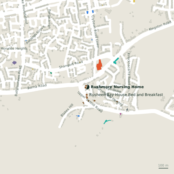
Plan of the surrounding 300 m
Getting to Rushmore Nursing Home
- By bus
- The nearest stop is Barna Road, served by Bus Éireann, 160 m away.
- Directions from where you are
- Open the model above, tap the pin and choose “Directions here”; the route is drawn from your own position.
While you are there
1 shop within 300 m, including Tesco.
Kingston Road itself has 10 named places on the map.
Within a short walk
- Cashelmara Lodge Bed and Breakfast15 mGuest houses
- Seashore Lodge Bed and Breakfast16 mGuest houses
- Rusheen Bay House Bed and Breakfast82 mGuest houses
- Sea Breeze Lodge Bed and Breakfast98 mGuest houses
- Rose Villa Bed and Breakfast111 mGuest houses
- Bayview Holiday Park149 mCaravan parks
- The Four Winds Lodge163 mGuest houses
- The Four Winds B&B167 mGuest houses
Also on Kingston Road
- CaponesRestaurants
- EducogymGyms
- Kingston Medical CenterDoctors
- Knocknacarra District Community SchemeSocial services
- Orlik - Polski SklepConvenience stores
- Platinum Tanning StudioBeauty
Everything on Kingston Road (10 places)
Other social services in Galway
- Knocknacarra District Community Scheme223 mKingston Road
- Saint Davids Retirement Home314 mGentian Hill
- Glenoaks Hotel2.0 kmBishop O'Donnell Road
- Osterley Lodge2.3 kmLower Salthill Road
- Saint Mary's Residential Centre3.0 kmShantalla Road
- Order of Malta3.3 kmSaint Helens Street
- Samaritans3.6 kmNun's Island
- St. Francis Primary & Daycare3.8 kmUpper Newcastle Road
Questions people ask
Where is Rushmore Nursing Home?
On Kingston Road in Galway, 4.2 km west of Eyre Square.
Are there other social services nearby?
28 other social services in $Galway; the closest is Knocknacarra District Community Scheme, 223 m away.
Source record: OpenStreetMap way/163102403, read on 2026-09-18. The street is the mapped address where there is one, otherwise the nearest named road. Distances are straight lines.