Ballybane
The name means the white homestead, and the townland of Ballybaan More in the parish of St Nicholas had ringforts and a souterrain long before the estates came. Ballybane today is a loosely bounded suburb on the east side, with the Old Dublin Road to the south, Mervue west, Ballybrit north and Doughiska east, and the university campus everyone still calls GMIT at its southern edge.
Checked against the source on 2026-09-19.
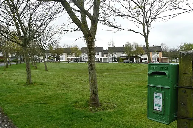
Graham Horn, CC BY-SA 2.0 via Wikimedia Commons

Ballybane Community Centre, Ballybane Library, Ballybane Pharmacy, Ballybane Garda Station, Atlantic Technological University Galway on the 3D model; tap a pin for its page and directions.
Built in the late twentieth century
The ruins of the medieval church of St James and its graveyard lie in the neighbouring townland of Ballybaan Beg. The suburb was developed in the late twentieth century: the shopping centre opened in 1981 and the parish of St Brigid dates from 1995, with its church off Castlepark Road. A Joyce's supermarket traded in the centre until Tesco bought the chain in November 2021, and the Lantern Bar closed in 2019 after complaints and Garda call-outs.
Students, a library and hard streets
Because the ATU campus is next door, many students live here, with residences such as Glasán Student Village built for them. The Ballybane Community Resource Centre runs courses in cookery, yoga, beauty and DIY, there is a men's shed and a community garden, and the library is one of only three that Galway City Council operates. Not all the news has been good: in May 2019 the Irish Times reported damp, mould, failing heating, overflowing sewerage and no play areas at the Traveller halting sites of Clós na Choile and Fána Glas, and the following month drone footage showed five burnt-out and stripped houses at Fána Glas. The model pins the community centre, the library, the pharmacy and the Garda station.
Questions people ask
Where is Ballybane?
Is there a library in Ballybane?
When did Ballybane shopping centre open?
Written from Wikipedia, "Ballybane" (CC BY-SA 4.0), read on 2026-09-19, and from the OpenStreetMap places on the model. Nothing has been added from memory; follow the source for its footnotes.